Polygon Filter
The polygon filter is a special type of component which allows the user to draw an area on the map and filter data for this area.
Example
Interaction
Drawing a new area to filter
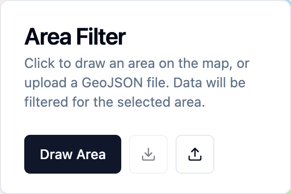
Click on 'Draw Area' to enter the drawing mode. Then click on the map to add points to the area, clicking on the first point again when you are finished drawing the polygon.
To remove an active area filter, click on 'Remove Area Filter'.
Importing and exporting areas
Areas can also be imported by using the ![]() icon. Areas can be exported by using the
icon. Areas can be exported by using the ![]() icon.
icon.
Both exports and imports use the GeoJSON format with a Feature Collection containing a single Feature with the Polygon type. Filtered areas are not persisted when a map is saved.