Filter Component
The Filter component allows users to interactively refine the data shown on their map and in data components. This is particularly useful when you want to enable users to explore specific subsets of data - for example, showing only certain types of locations on a map, or filtering data by date ranges.
Available Filter Types
Filters can be configured for both categorical and continuous data fields:
Categorical Fields
For fields containing discrete categories (like store types, product categories, or status values), the following filter types are available:
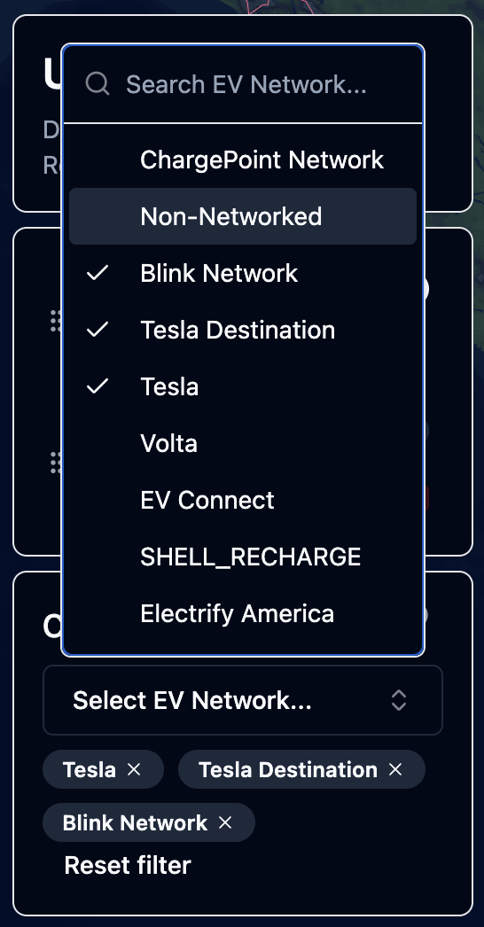
- Dropdown with Search: A searchable dropdown menu that displays all unique values
- Supports both single and multiple value selection
- Includes search functionality to easily find values in large lists
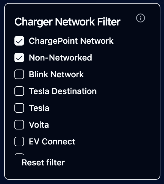
- Radio/Checkbox Buttons: Display all options as clickable buttons
- Radio buttons for single selection
- Checkboxes when multiple selection is enabled
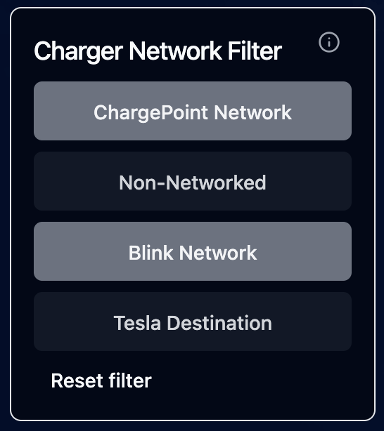
- Toggle Switches: Display options as toggle switches
- Best for categorical fields with a small number of options
- Supports both single and multiple selection
Continuous Fields
For numeric fields (like prices, distances, or timestamps), two slider types are available:
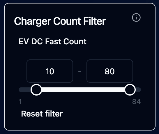
- Range Slider: Select a minimum and maximum value
- Useful for filtering numeric ranges (e.g., "show prices between $10 and $50")
- Single Value Slider: Select a single threshold value
- Useful for filtering above or below a specific value
Adding and Configuring Filters
- Open the Edit Map sidebar and navigate to the "Components" tab
- Click "Add Component" and select "Filter"
- Configure the following settings:
- Data Source: Select the data source containing the field to filter
- Field: Choose the field to filter on
- Filter Type: Select the appropriate filter type (options vary based on field type)
- Allow Multiple Selections: Enable/disable multiple value selection (for categorical filters)
- Title & Description: Add optional explanatory text
- Apply to Layers: Select which map layers and data components this filter should affect
Applying Filters to Layers and Components
Each filter can be configured to affect specific map layers and data components. When configuring a filter, you can select from:
- Any map layer using the same data source
- Data components (Big Numbers, Bar Charts, Histograms) using the same data source
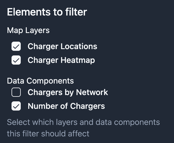
This allows you to create focused filters that only affect relevant visualizations on your map.
Saving Filter States
When you save a map that includes filters:
- The filter configuration (type, field, affected layers) is saved
- The current filter selection (selected values or ranges) is preserved
- Users who load the map will see the same filtered view
- Users can modify filter selections even in read-only mode
Best Practices
- Use descriptive titles and descriptions to help users understand what they're filtering
- Consider the number of unique values when choosing a filter type:
- Dropdowns work well for many values
- Radio buttons and toggles are better for fewer options
- Remember that filters affect both the map and any selected data components
- Multiple filters can be combined to create complex queries
Examples
Here are some common use cases for filters:
- Filtering points-of-interest by category
- Filtering sales data by product type
- Showing only high-value transactions