Map Layers
The map layers pane lets you configure how the data from data sources are visually represented on the map.
Honeycomb supports five types of map layers:
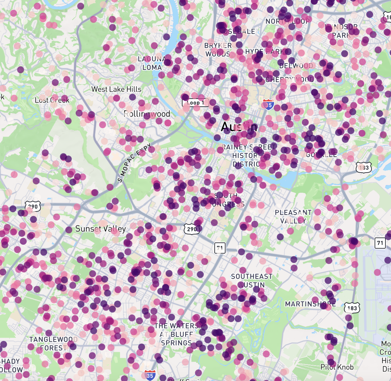
Point Layers show individual data points on a map.
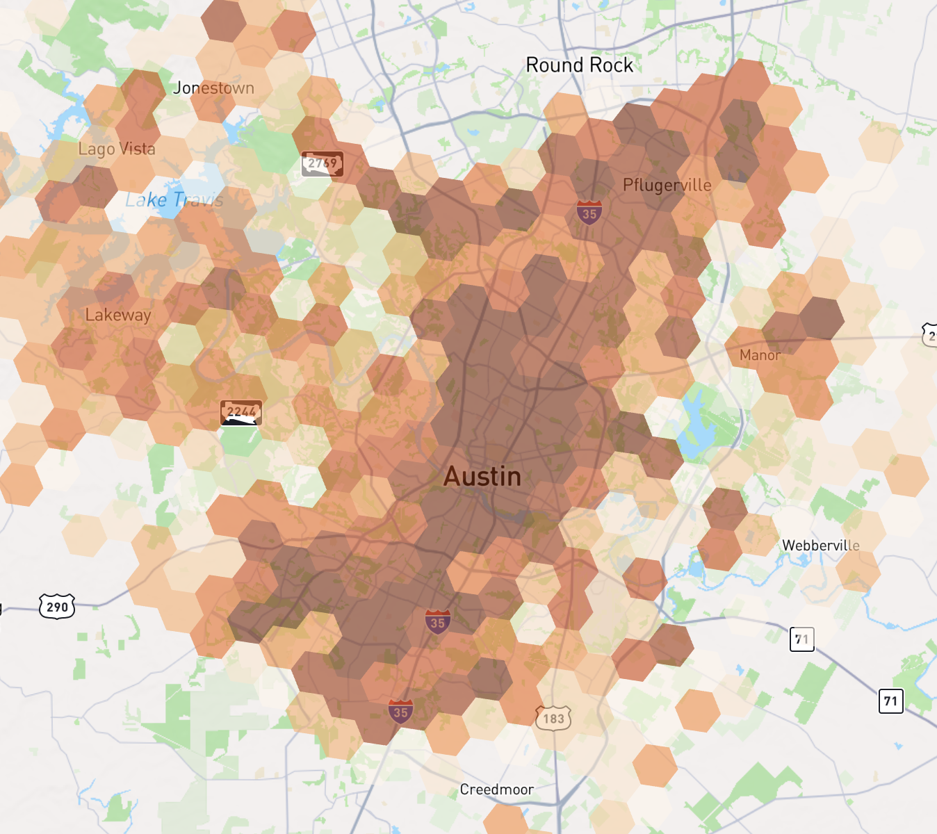
Honeycomb Layers aggregate and visualize data using the H3 grid system.
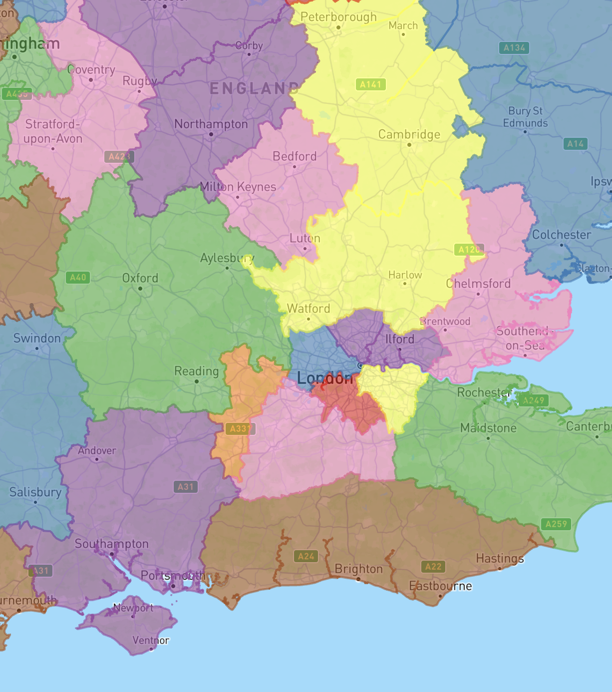
Polygon Layers display geographic areas as polygons on the map.
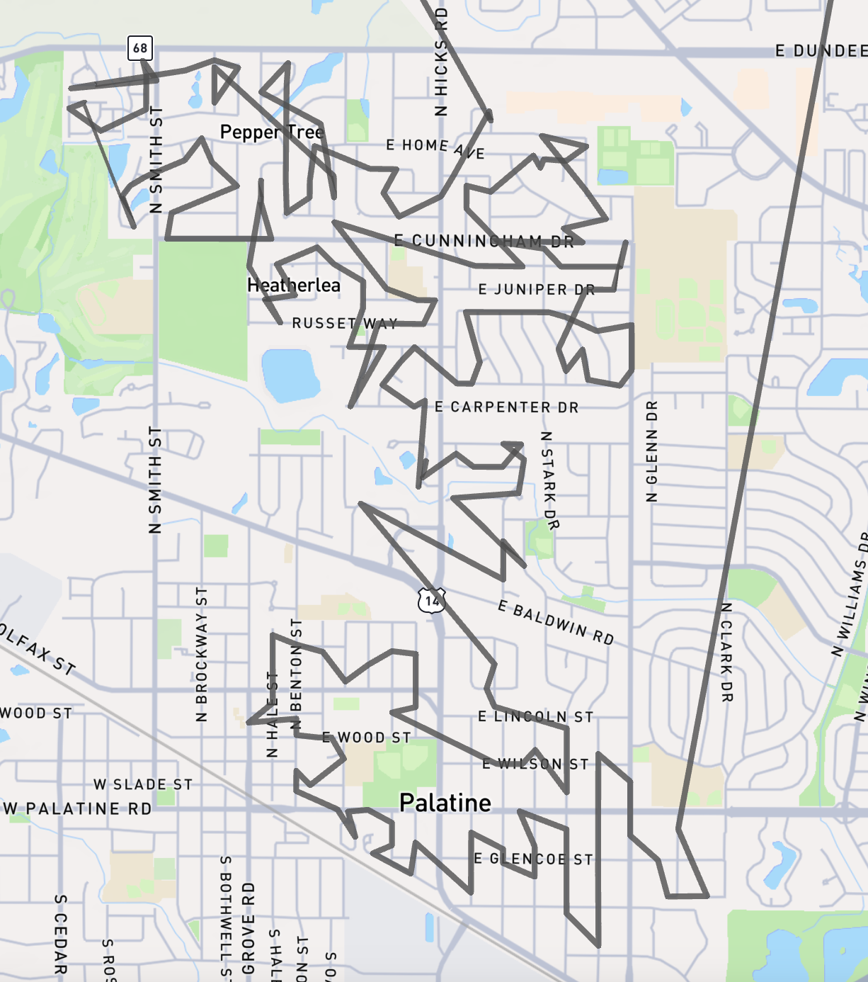
Line Layers visualize linear features like routes, roads, or boundaries.
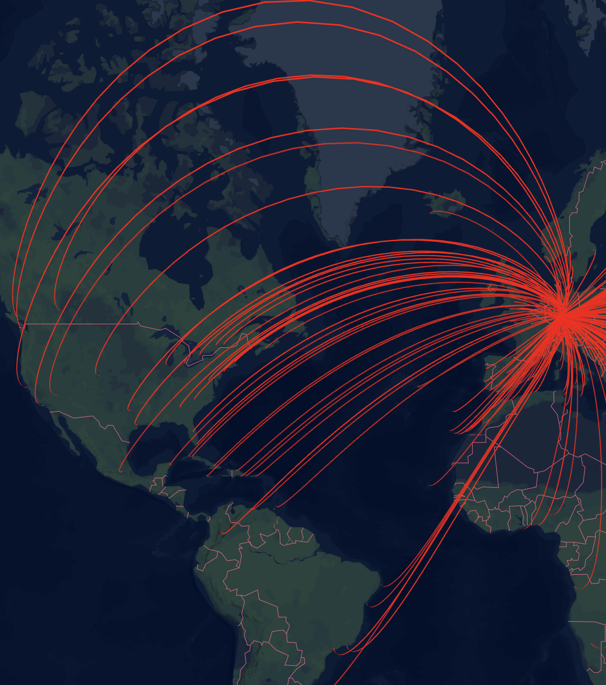
Arc Layers draw arcs between origin and destination points to show connections or flows.
To change the type of a layer, use the 'Layer Type' dropdown.
Options relevant for all types of map layers:
ID
The id is generated by Honeycomb and is not editable. It may be useful if you are dynamically generating maps using Honeycomb Map Definition JSON (documentation coming soon).
Label
A user-friendly display name for the map layer. This name will be shown in the UI if you add a 'Legend' component to allow toggling layers on/off.
Data Source
The data source that supplies data for this map layer. Each map layer can only show data from a single data source.
Layer Type
The type of map layer to show. Options are Point Layer, Honeycomb Layer, Polygon Layer, Line Layer, and Arc Layer.
For specific configuration options for each type of layer, look at the following pages:
- Point Layer Documentation
- Honeycomb Layer Documentation
- Polygon Layer Documentation
- Line Layer Documentation
- Arc Layer Documentation
Visibility
Basic Visibility
Visibility controls whether the layer should be visible on the map or not. If you want to allow users of the map to toggle layers on/off, you can add a Legend component to the map.
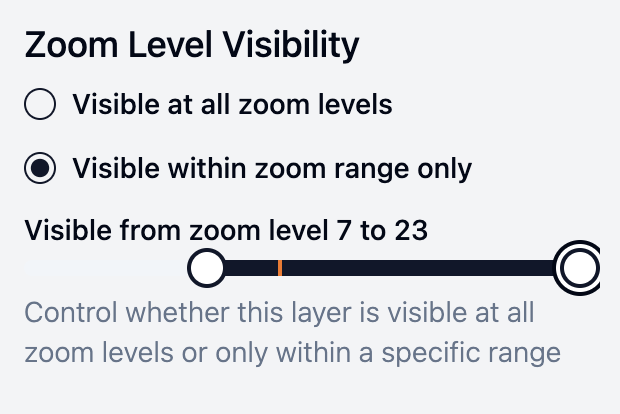
Zoom Level Visibility
You can also control visibility based on the map's zoom level. This is useful when you want to show different levels of detail at different zoom scales. For example:
- Show detailed point data only when zoomed in to city level
- Display a high-resolution H3 layer only at closer zoom levels
- Switch between different layer types as users zoom in and out
To configure zoom-based visibility:
- Enable "Visible within zoom range only" for the layer
- Use the slider to set the minimum and maximum zoom levels where the layer should be visible
- The layer will automatically show/hide as users zoom in and out of these levels
The zoom level scale ranges from 0 (global view) to 23 (street level):
- 0-4: Continental scale
- 5-8: Country/regional scale
- 9-12: Metropolitan scale
- 13-15: City scale
- 16+: Street/building scale
Opacity
Opacity (the opposite of transparency) controls how 'strong' the layer appears on the map. If the opacity is set to 100%, the map layer will completely cover the basemap and layers below it. If the opacity is set to 0%, then the layer will be completely transparent and no longer visible.
Type-specific options
Each type has different map layer options which are specific to that type. See the documentation for each type to see these options.